

Case Study - Setting out weed control tender made easier with geospatial data analysis
Basildon Council

Basildon is the largest town in the borough of Basildon with a population of 107,123 in the county of Essex, England. It lies 26 miles east of Central London, 11 miles south of the city of Chelmsford and 10 miles west of Southend-on-Sea. Nearby smaller towns include Billericay to the northwest, Wickford northeast and South Benfleet to the southeast. It was created as a new town after World War II in 1948 to accommodate the London population overspill, from the conglomeration of four small villages, namely Pitsea, Laindon, Basildon and Vange.
CHALLENGE
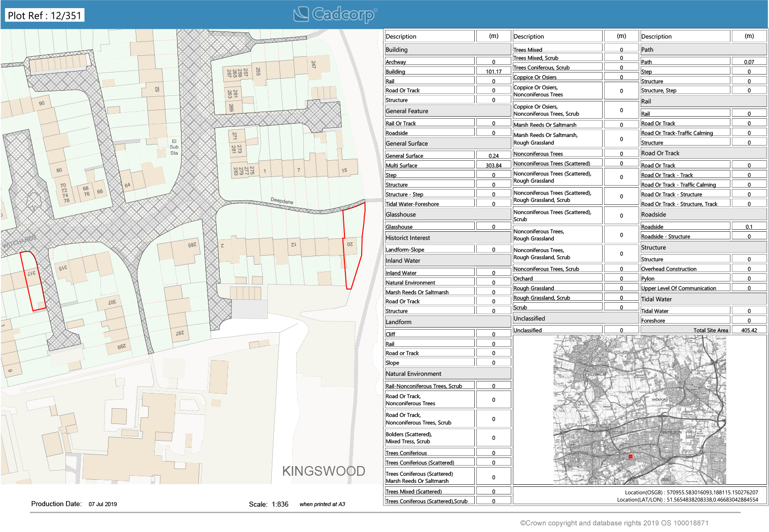
Basildon Council runs a weed control programme throughout the borough. The council owns many, small parcels of land that are distributed right across the borough. To set out a tender for grounds maintenance, it first had to ascertain land ownership and then separate these areas by type of surface. Having a member of council staff measuring each individual block and working it out was going to be too time-consuming.
SOLUTION
Basildon Council has been using SIS as their GIS for many years. For this project, the council selected the NEC Data Analysis and Modelling Service. NEC was able to create a definitive layer of land ownership, calculate the corresponding Ordnance Survey MasterMap Topography Layer® land classifications and create a report including both a map and tabular output. This included detailed PDFs and spreadsheets with all the necessary information broken down.
OUTCOMES AND BENEFITS
Having the output in this report format makes tendering easier for Basildon Council. Long term, it brings the benefit of a proactive weed control programme. The data analysis by NEC is reusable and is already being used by its cleansing department for a similar project. As Basildon Council starts using it more, it will bring efficiencies to tendering and their general maintenance programming.
To find out more about our Geospatial Solutions for Government, get in touch with us.