

Case Study - Using spatial insight to improve homes and neighbourhoods
Vico Homes

Vico Homes has over 32,000 homes across the north of England, home to tens of thousands of people, and people are at the centre of what they do. They have ambitions to grow, offering more homes to the people who need them and investing in improving the homes they have.
Vico Homes is built on the foundations of WDH.
CHALLENGE
An integral part of the Vico Homes ‘Vision to 2035’ is a £146 million investment in making its homes more energy efficient, ensuring housing stock exceeds safety and compliance standards, and that estates are more attractive and safer places to live.
With a target of 12,000 homes meeting EPC Band C by 2030, improving fire safety in all buildings and ensuring 100% of boilers and electrical systems are serviced annually is a vast undertaking.
SOLUTION
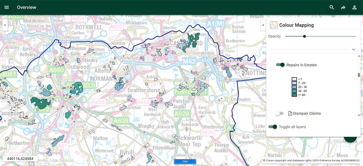
For Vico Homes, investment is based on a whole dwelling, whole street and whole estate approach. Using SIS WebMap, they have created multiple interactive maps, informing teams across the organisation of the location of assets, ownership, and development projects. All business data is displayed on detailed and up-to-date Ordnance Survey® digital maps.
Vico Homes is proactively managing its properties and estates to ensure it provides safe and decent homes. It tracks the number of repairs, disrepair claims, EPC ratings, and types of insulation. Integrating this data with spatial data in an easy-to-navigate map gives the Repairs Team a more informed understanding of housing estates. As SIS WebMap links directly to the organisation’s asset management system, information on a property includes the full inspection schedule and repair inventory, enabling them to resolve issues promptly.
OUTCOMES AND BENEFITS
Over the last year, Vico Homes has:
- completed 102,414 general repairs
- fixed 5,606 emergency repairs
- fixed 95.1% of repairs on the first visit
- took an average of 8.6 days to complete repairs
The future public-facing web map will share relevant information for both existing and potential tenants and will allow members of the public to report incidents online.
To find out more about our Geospatial Solutions for the Housing sector, get in touch with us.