



Havebury Homes unlocking spatial intelligence across the entire organisation

Before investing in web mapping, the Havebury Homes relied on physical contract maps, paper documents, scans, and spreadsheets to interpret its land, assets, and responsibilities. It was difficult to compare and cross-reference, and joined-up thinking was almost an impossibility.
The requirement to improve geospatial data was identified in long-term strategic plans with a focus on service charges and grounds maintenance. It required a solution that worked with its existing data, was compatible with its IT ecosystem, and could be shared widely across the organisation.
“NEC provides flexible applications that integrate with our current systems and allow us to cost-effectively share mapping data in a highly customisable way.”
Phillip Walton
ICT GIS Specialist, Havebury Homes
The GIS was centralised, and SIS WebMap was deployed for sharing maps and business data in an intuitive and easy-to-use interface. The application integrates with Havebury’s existing spatial database and IT infrastructure with the added security of multifactor authentication. The maps are viewable through a web browser, working seamlessly across various platforms and catering to different users within the organisation.
SIS WebMap provides advanced capabilities for presenting and interrogating spatial data, and maps have been created to meet teams and project requirements across the entire organisation. This includes Neighbourhoods & Estates, Fencing, Development, Grounds Maintenance, Asset Management, Tenant Engagement, and Service Charges.
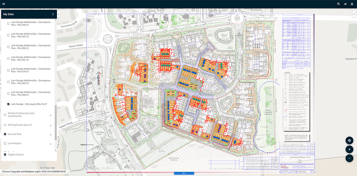
The system is designed to be self-service, and teams can quickly create a new web map.
SIS WebMap has provided Havebury with a wide range of time-saving benefits. These include:
- Quicker informed decision-making as proposals, landscaping, shared ownership, conveyancing, Land Registry and Ordnance Survey® data can all be viewed simultaneously on a single map
- Targeted grounds maintenance and resident engagement using search and buffer options to quickly display results in a table with filtering capabilities
- Reduced unnecessary site visits. For example, the feasibility of initial fencing enquiries can now be measured and assessed online
As the adoption of SIS WebMap expands, Havebury aims to leverage the benefits further to meet their broader strategic goals of affordable housing, community development, and meeting ESG targets.
“It’s more than simply saving time. SIS WebMap is making the previously impossible, possible.”
Phillip Walton
ICT GIS Specialist, Havebury Homes
Housing associations and land and property organisations are realising the benefits of GIS for all phases of asset management and maintenance. These can range from negotiating grounds maintenance contracts to ensuring the sustainability of stock performance and planning improvements in the community.